Infos :
Pictures :
Site Links :
Help of Travel :
|

|
Kaokoland & Damaraland : Pictures of Namibia
Opuwo - Ruacana Falls - Palmwag - Landscape...
|
Kaokoland (also called Kaokoveld) is an area in Northern Namibia , in the Kunene Region.
It is one of the wildest and less populated areas in Namibia, with a population density of one person every 2 km², that is 1/4 of the national average.
The most represented ethnic group is the Himba people, that accounts for about 5,000 of the overall 16,000 inhabitants of Kaokoland.
The main settlement in Kaokoland is the city of Opuwo.
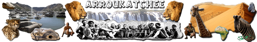
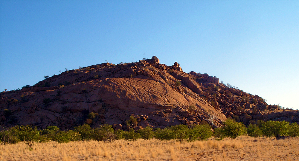
Kaokoland
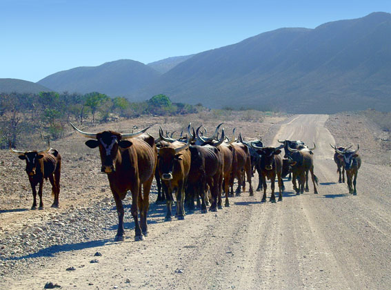
Herds of cows in the kaokoland
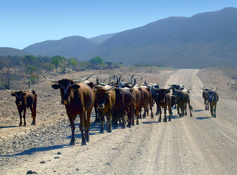
Burnt Mountain
The Burnt Mountain or Verbrandeberge is at the end of the D3214, a 12-km section of mountain rising 100 m above the plain.
During the day the mountain is bleak and uninviting, however, the distinctive colouring of the rocks appears at sunrise and sunset when the imaginative might contest that the mountain is on fire.
The rocks are dolerite and are believed to have been formed more than 130 million years ago as a result of volcanic activity.

Burnt Mountain near of Twyfelfontein
Petrified Forest
Situated 42 km west of Khorixas in north-west Namibia, lies a small area containing over 50 fossilised tree trunks over 250 million years old.
They are thought to have been deposited into a silica rich environment at the site by flood water from areas further north, and were excluded from contact with oxygen which prevented decay.
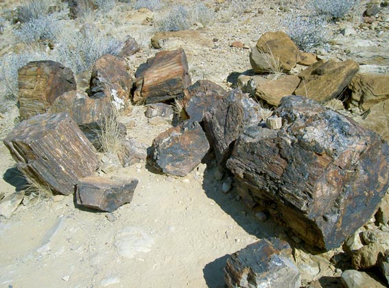
Petrified Forest
Within the area can be seen the 'living fossil' plant Welwitschia mirabilis, some of which are 2000 years old, and can grow to 8m across.
The area is a Namibian National Monument, and unsurprisingly it is illegal to remove even tiny amounts of the fossilised trees.
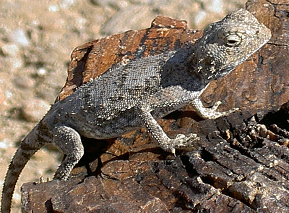
Lizard in Petrified Forest
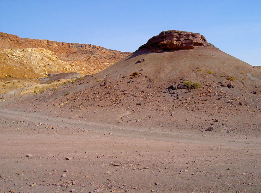
Organ Pipe
The site is called the Organ Pipes because the rock columns resemble the pipes on a large church organ.
These were thought to have formed about 120 million years ago when the dolerite shrank as it cooled, forming these marvellous angular columns up to 5m high in the process.
Retracing your tracks from Twyfelfontein, take the left fork which you ignored earlier (see directions above), on to the D3254.
After about 3km there's a small gorge to your left, and above it a flat area used for parking.
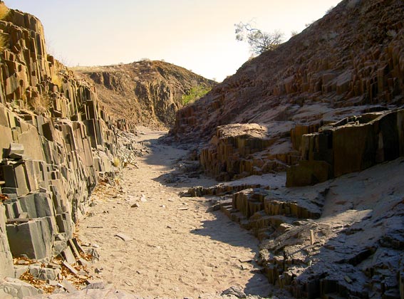
Organ Pipe
Fort Sesfontein
The Lodge is situated inside Fort Sesfontein which has been reestablished authentically even to details from the ruines of a historical Fort built in 1896.
It is a monument providing safety and coziness but naturally fulfils the demand for modern facilities according to todays standards.
Descendants of the natives of the Damaras, Hereros and Himbas are your hosts.Discover the fort Sesfontein
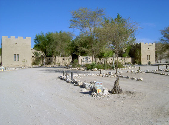
Fort Sesfontein
Landscape of Kaokoland
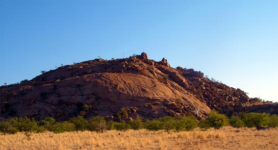
Landscape of Kaokoland
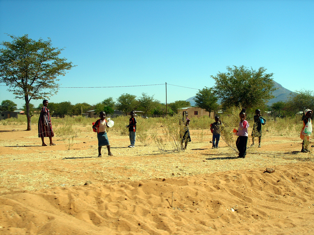
Namibian Children
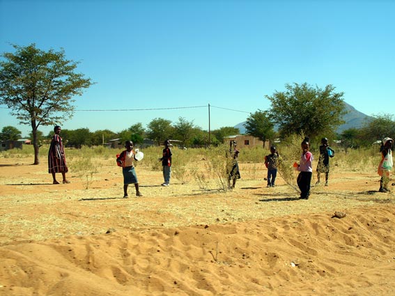
Namibian Children
The Palmwag Concession
The Palmwag Concession is an area of 5,500 km 2 in the Kunene Region of North West Namibia.
This region provides habitat for a variety of rare species of plants and animals, including those adapted to the semi-desert conditions such as elephants, mountain zebra and giraffe.
The Concession also supports nearly 70% of the world's largest free-ranging population of black rhinoceros and functions as the crucial core area in the region.
The unique fauna and flora within the Concession also serve as a national, regional and global attraction.
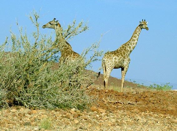
The Palmwag Concession
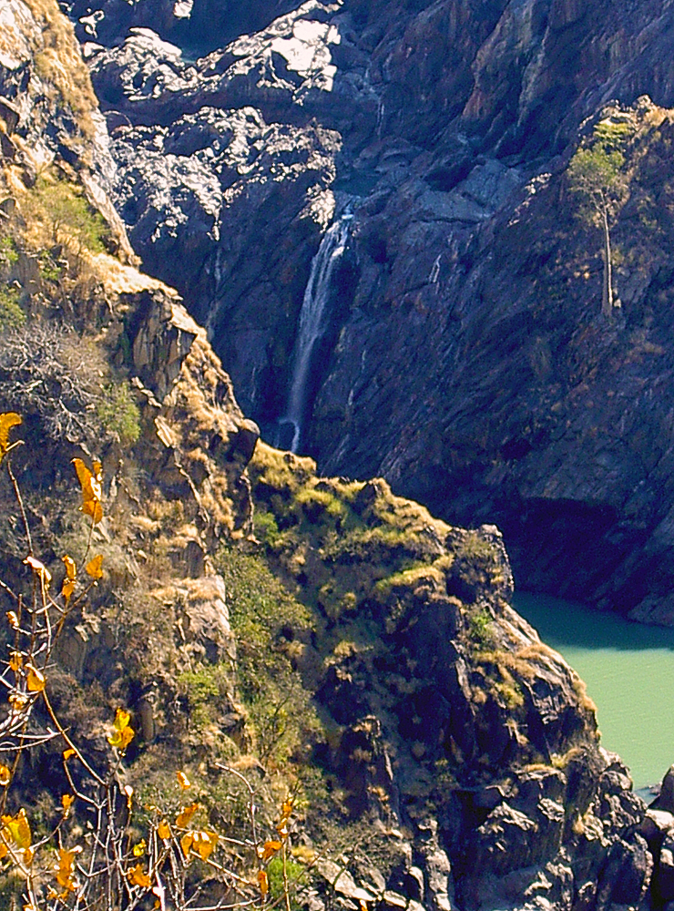
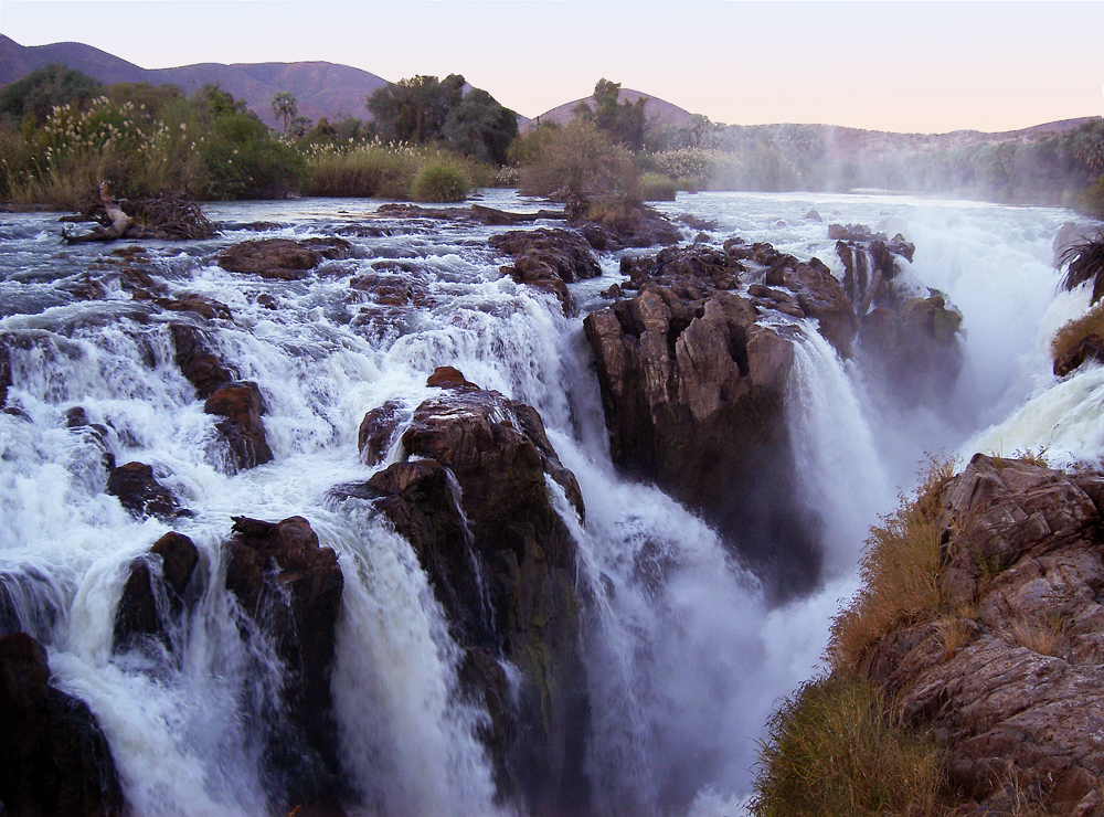
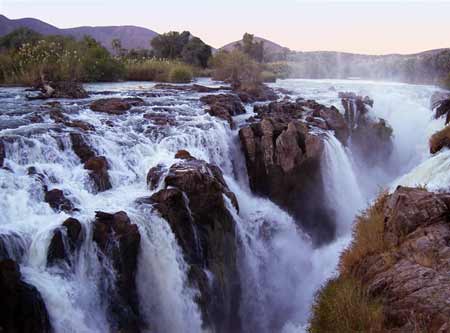
Rucana Falls
Ruacana Falls are waterfalls located on the Cunene River in Northern Namibia near Ruacana.
The waterfall is 120 meters high and 700 meters wide in full flood.
The Epupa Falls on the Kunene River ("Kunene" is the Angolan spelling of the river) are located 135 km downstream on the border of Angola and Namibia
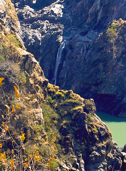
Rucana Falls
The African Baobab
The African baobab tree is a large waterlogged. It can reach 25m in height and have a diameter of 12m.
It is often called the tree upside down because he did not have many leaves and branches like a root.
The baobab has a slow growth, longevity is large and can reach 2000 years. The Baobab is easy to recognize by its peculiar shape. He needed to face the other plants.
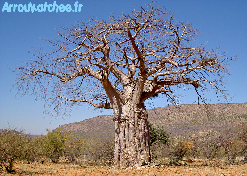
The African Baobab
A giant anthill
A giant anthill overview on the edge of the road in Namibia.The mounds can reach heights of eight meters in Africa.
This one has a height of about three meters. Her neighbors push squarely into the trees.
Termites construct mounds of earth, wood digested ...The nest is the aerial part of the nest.
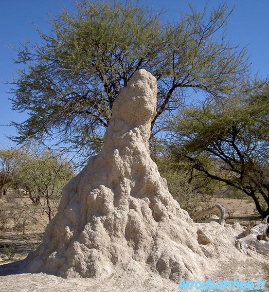
A giant anthill
Opuwo
Opuwo is the capital of the Kunene Region in north-western Namibia.
The town is situated about 720 km north-northwest from the capital Windhoek, and has a population of 12,000 (2009).
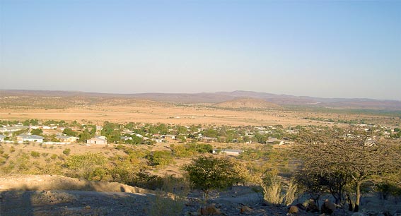
Opuwo, Capital of Kaokoland
Pieter de Villiers of the Congress of Democrats is the town's mayor.
The first office to be established in the area was the colonial administrator in Kaoko in 1997, which was located at the Swartboois Drift on the banks of the Kunene River before the name of the place was changed to Opuwo.

City Opuwo.
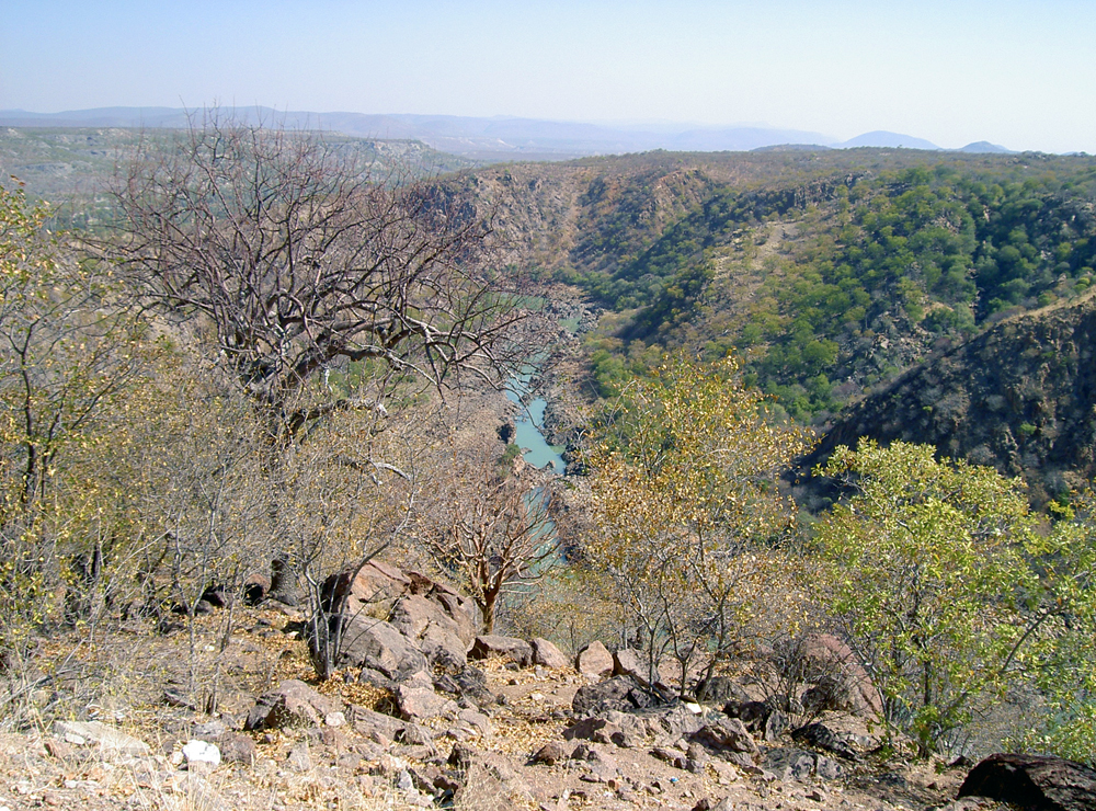
Cunene River
The Cunene River (Angolan spelling) or Kunene River (Namibian spelling) is a river in Southern Africa.
It flows from the Angola highlands south to the border with Namibia.
It then flows west along the border until it reaches the Atlantic Ocean.

Cunene River
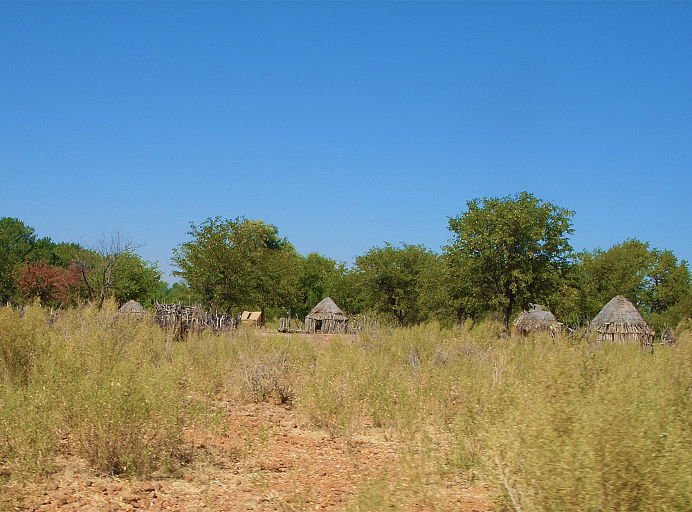
Himba village in Kaokoland
The Himba of northwest Namibia live in houses that are just simple cone-shaped structures made with saplings covered in mud and dung.
Discover the Himba people
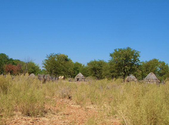
Himba village in Kaokoland
Epupa Falls
The Epupa Falls (also known as Monte Negro Falls in Angola) are created by the Kunene River on the border of Angola and Namibia, in the Kaokoland area of the Kunene Region.
Discover Epupa Falls
Epupa Falls
|
|
|
|
|
|
|
|
|