
Travel Guide :
|
Namibia
|
|
South Africa
|
|
Botswana
|
|
Zimbabwe
|
Pictures :
|
Namibia
|
|
South Africa
|
|
Botswana
|
|
Victoria Falls
|
Site Links :
|
Travel journal
|
|
Videos
|
|
Forum
|
|
GuestBook
|
Compare :
|
Car Rental
|
|
Plane Tickets
|
|
Your holiday
|
|
Hotel
|
|
Currency Converter
|
|
» Southern Africa » South Africa » Provinces » Northern Cape » De Aar De Aar Travel GuideMap | Climate | Transportation | Attractions | Accommodation | Other townsDe Aar is a town of over 46,000 inhabitants, located southeast of the Northern Cape Province, in the Pixley ka Seme District. The city covers about 119km² and a density of 55 inhabitants/km². The main language spoken at De Aar is 86% Afrikaans, Xhosa and monitoring of English. The economy of De Aar based on the distribution of wool production and animal husbandry. The city is also popular for hunting. Postal code is - De Aar Its area code: 053 Coordinates: 30° 39'00'S 24° 01'00'E Phone number emergency : Police: 053 632 9500 Firefighter: 053 632 9100 Hospital: 053 631 4361 I. De Aar map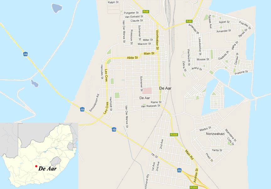
Street Map of De Aar II. Climate and geography of De AarSituated 1280 meters above sea level, the climate of De Aar is rather desertic, with hot summers (cool nights) and cold winters.It rains an average of 196mm per year, the precipitation occurring mainly during the summer and fall. The lowest temperature recorded was -10°C and 40.7°C for the highest.
III. Getting around in De AarBy car :The main roads of De Aar are : - N10 : Allowing to reach Upington, Middelburg, the Namibian border post.- R48 : Petrusberg, Philipstown. - R348 : to reach Richmond. By Plane :The only airport of De Aar, is a military airport. The nearest airports are at Kimberley and Bloemfontein.By bus :No information on bus of De Aar.By Train :Situated on the railway between Cape Town and Kimberley, De Aar is the second junction line railway in the country, see map above.
Map of train lines and different company
Railway serving the cities of South Africa 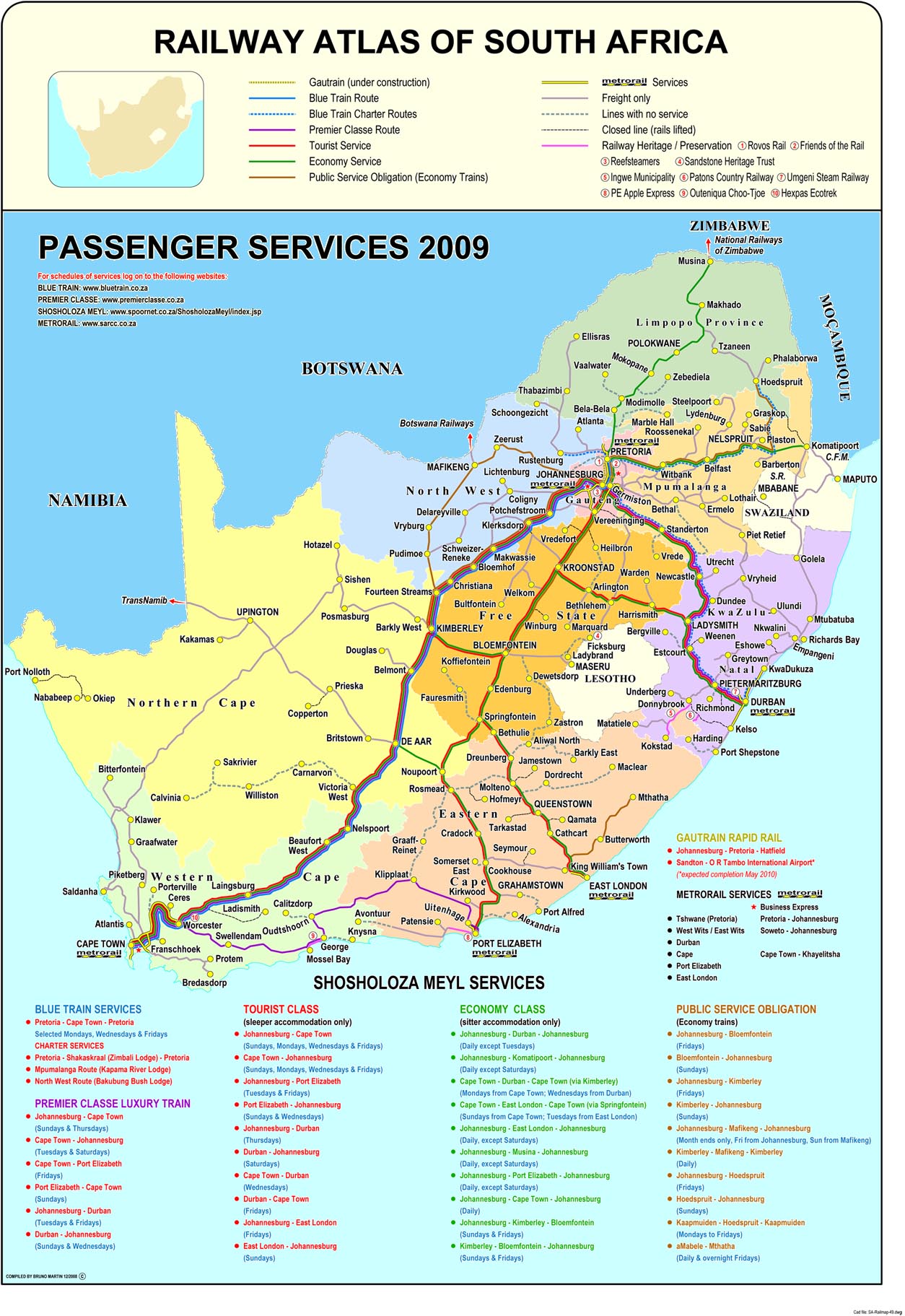
Click to enlarge map IV. What to see and what to do in De AarThere are ancient rock carvings of the Khoisan people, located on land farms Nooitgedacht and Brandfontein.You can also walk to the "Garden of Remembrance", garden honoring British troops killed in the Anglo-Boer War. Parks and nature reserves near De Aar :- Doornkloof Nature Reserve- Karoo Gariep Conservancy - Rolfontein Nature Reserve V. Where to stay in De AarHere is a list of hotels and lodges where you can stay :
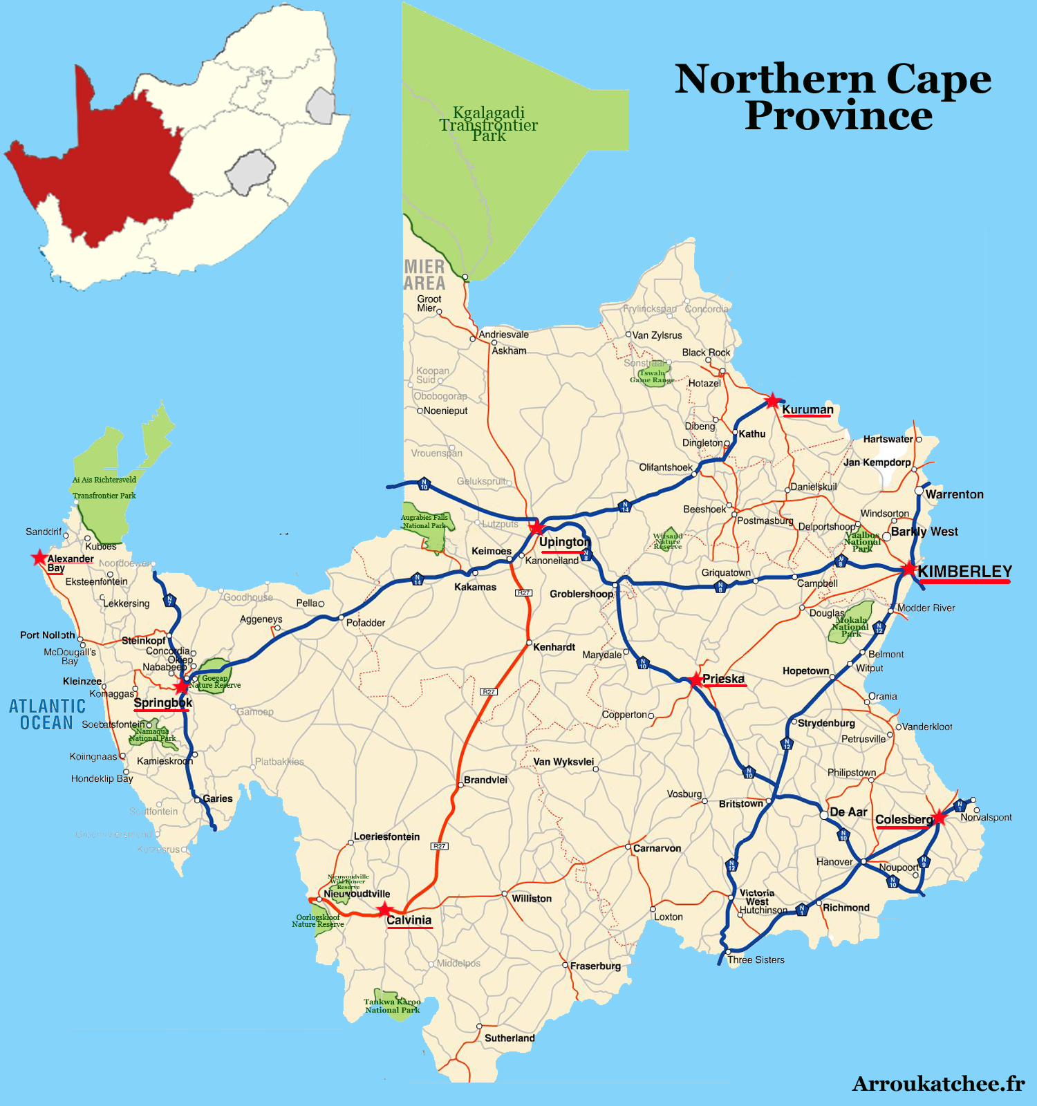
VI. Other cities in Northern CapeOther major cities in Northern Cape are :
VII. Additional InformationSource : 2012 |
|||||||||||||||||||||||||||||||||||||||||||||||||||||||||||
|
Partners
|
Sitemap
|