Infos :
Pictures :
Site Links :
Help of Travel :
|
|
Brukkaros Volcano
Prepare your Travel to Namibia
I. Description of Brukkaros Mountain
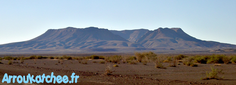
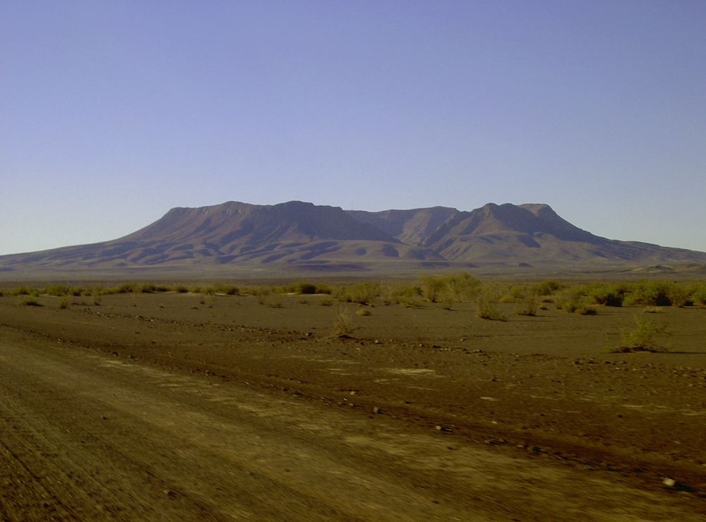
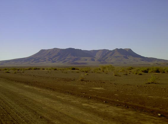
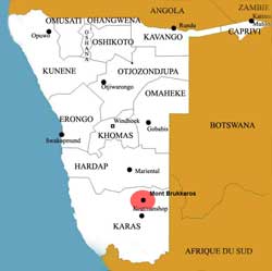
Mount Brukkaros is about 130 km (1h30) northwest of Keetmanshoop, it can be seen at more than 100km.
It culminates at 1580 m on the territory Nama near the village of Berseba.
In a landscape devoid of vegetation, this mass of dark lava rises abruptly from a plain sunburned. The spur at the base of the mountain is accessible only by 4x4.
A well maintained trail leads to the end of the road through erosion of the shoreline south to the mountain.
The course was carved in 1930, when the Smithsonian Institute installed an observatory on the western edge of the crater to explore the solar surface.
 Brukkaros : Volcano of Namibia
Although it is still standing, the observation station has not functioned for many years.
At the turn of the century, the Germans maintained a Heliograph station east of Brukkaros.
Quite recently, a VHF radio was on the northern edge of Brukkaros.
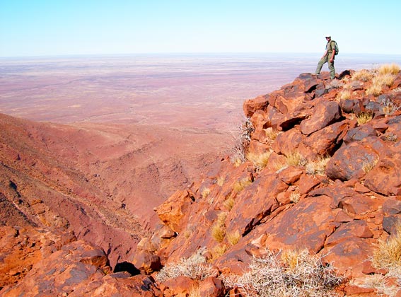
Brukkaros is not an extinct volcano, as suggested by its form. but the eroded remnants of a pile of rocks fragmented by a massive gas explosion there are 84 million years.
At its highest point at about 1580 m, a ridge surrounding a deep crater near 2000 m in diameter.
II. Formalities of Brukkaros Volcano
Some members of the local community (Community Nama Berseba venture) tries to promote Mt Brukkaros to attract visitors.
 Crater of Brukkaros
There is a small door and reception but is seldom required.
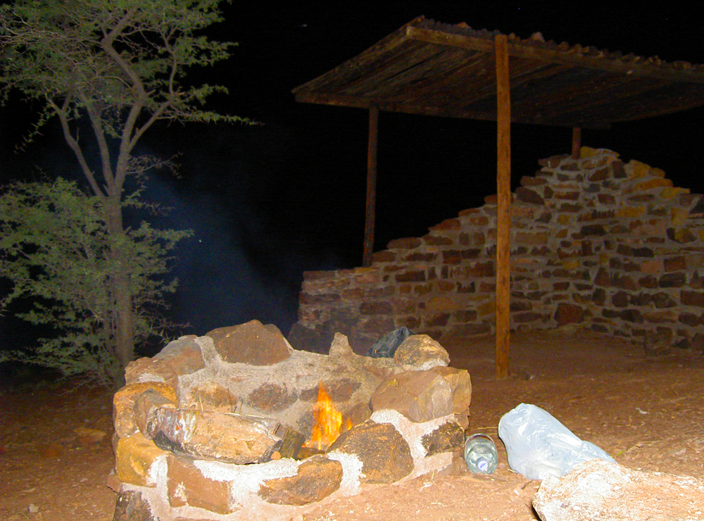
Eight campsites have been constructed, four are at the end of good quality gravel road and offers shelter and toillette dry.
you should take a supply of water for drinking or washing see.
Rate: N $ 35 per person.
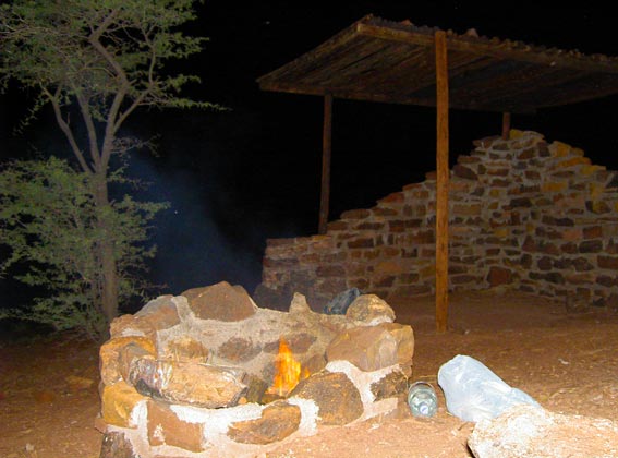 Campsite du Brukkaros
III. Activities on the Brukkaros
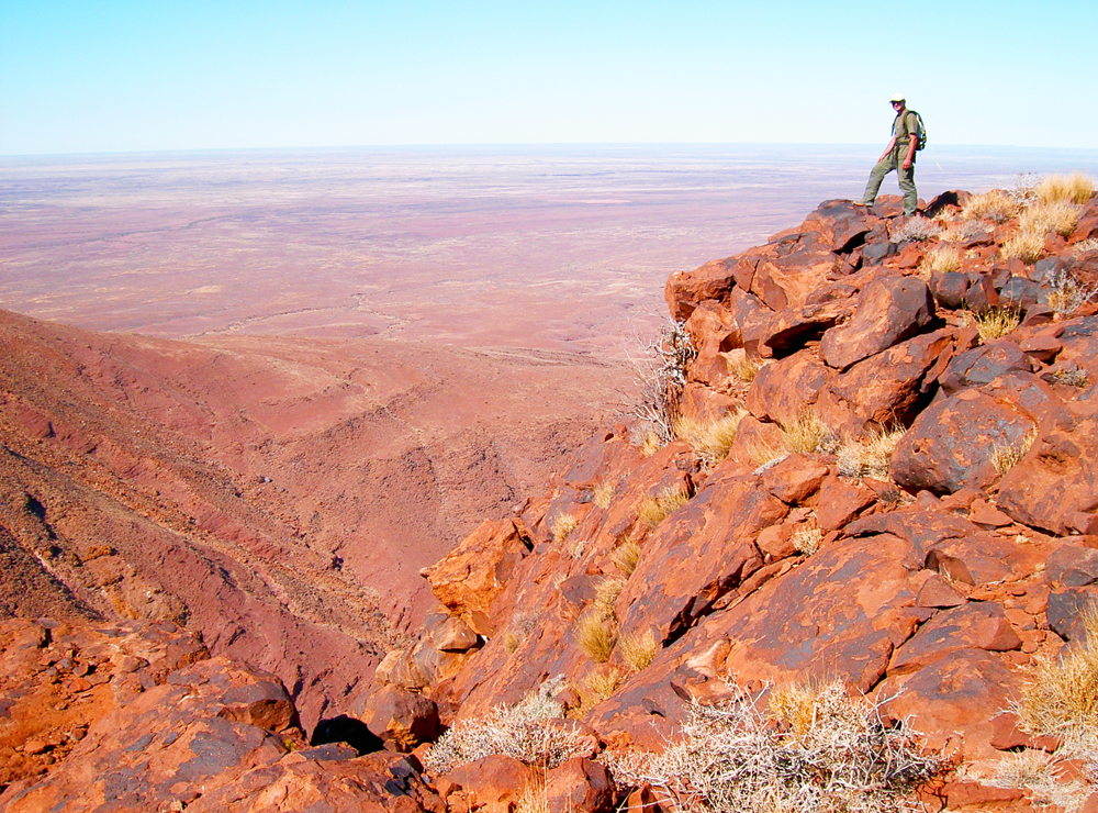
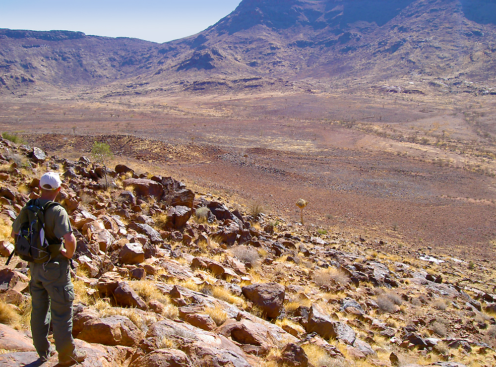
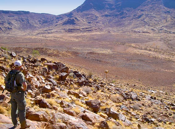
Scenery and hiking are the highlights of this attraction.
 Brukkaros's Namibia
The hiking may take 3-4 hours to all day.
A fairly good physical condition is required because the track is not well develloped.
IV.Access Brukkaros
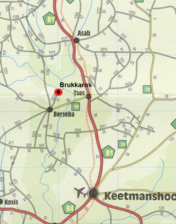
At the height of TSEs on B1 , M98 runway gravel from west.
Berseba reached, take the D3904 track which soon narrows, spins and climbs on the rocky flank of the volcano.
Halfway up, she ends on an embankment overlooking the dusty valley.
The continuation of the tour will be a 4x4 or by foot.
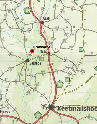
Map in Brukkaros
|
|
V.Accommodation on the Brukkaros
-
Camping Brukkaros : 35N $ per night per person.
» Hotels and Lodges near Brukaros:
» Hotels and Lodges in Keetmanshoop 95 km of Brukkaros
VI. Climate of Mount Brukkaros
Keetmanshoop |
January |
February |
March |
April |
May |
June |
July |
August |
September |
October |
November |
December |
Temperature max |
35 |
34 |
32 |
29 |
25 |
22 |
21 |
24 |
27 |
30 |
32 |
35 |
Temperature min |
19 |
19 |
18 |
14 |
10 |
7 |
6 |
8 |
11 |
14 |
16 |
18 |
Rainfall (mm) |
24 |
42 |
36 |
15 |
5 |
2 |
1 |
1 |
3 |
6 |
11 |
13 |
Weather live Berseba.
VII. Photos of Brukkaros Volcano
» Pictures of Brukkaros Volcana of namibia
VIII. Book on the Desert of Namib
- Travel Journal to Brukkaros
Source : 2008
|
|
|
|
|
|
|
|