Namibia Arroukatchee Southern Africa

Infos :

Namibia
South Africa
Botswana
Zimbabwe

Pictures :

Namibia
South Africa
Botswana
Victoria Falls

Site Links :

Travel Journal
Videos
Forum
GuestBook

Help of Travel :

Car Rentals
Plane Tickets
Your holidays
Hotels
Currency Converter


bagani


Facts
Maps
Money
Accommodation
Transportation
Formalities
Health-Safety
Climate-Geo
People-Towns
History
National Park
Fauna
Links

Bagani

Travel guide of Bagani in Namibia


Town of
Bagani
Map Tourist Attraction Car Rental Flight
Plane tickets
Campsite
Rest Camp
Hotel
Lodge
Weather
Climate


I. Bagani travel guide


bagani location
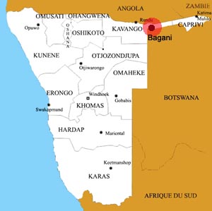
Location of the town of Bagani
bagani

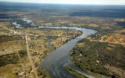
Bagan is a town of 2000 inhabitants, situated on the banks of the Okavango River in the Caprivi Strip in the Kavango region of Namibia.
Bagani is on the C48 road at 23 km north of the border post Mohembo, to get to Shakawe (Botswana) and 211 km from Rundu.

The city of Bagan is very little will builds with poor infrastructure, but it still has a petrol station, a clinic and a small school. The economic activitée villages is mainly due to agriculture.


II.Information on other towns in Namibia

Arandis
Aranos
Aus
Bagani
Gobabis
Grootfontein
Henties Bay
Kamanjab
Karasburg
Karibib
Katima Mulilo
Keetmanshoop
Khorixas
Khowarib
Kongola
Luderitz
Maltahohe
Mariental
Okahandja
Omaruru
Ondangwa
Opuwo
Oshakati
Oshikango
Otavi
Otjiwarongo
Outapi
Outjo
Purros
Rehoboth
Ruacana
Rundu
Swakopmund
Tsumeb
Uis
Usakos
Walvis Bay
Windhoek


Source : 2011


Partners
Sitemap