Namibia Arroukatchee Southern Africa

Infos :

Namibia
South Africa
Botswana
Zimbabwe

Pictures :

Namibia
South Africa
Botswana
Victoria Falls

Site Links :

Travel Journal
Videos
Forum
GuestBook

Help of Travel :

Car Rentals
Plane Tickets
Your holidays
Hotels
Currency Converter


mariental


Facts
Maps
Money
Accommodation
Transportation
Formalities
Health-Safety
Climate-Geo
People-Towns
History
National Park
Fauna
Links

Mariental

Travel guide of Mariental in Namibia


Town of
Mariental
Map Tourist Attraction Car Rental Flight
Plane tickets
Campsite
Rest Camp
Hotel
Lodge
Weather
Climate


I. Mariental travel guide


mariental location
Location of the town of Mariental
mariental

Mariental is a town of 10,000 inhabitants was founded in 1912, located in south-central Namibia.
Mariental is the administrative capital of the Hardap Region.
It is located 274 km south of Windhoek (Road B1) and 232 km north of Keetmanshoop (Route B1) .

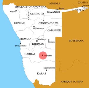
Mariental is also connected to the network of Namibia Railway (the TransNamib Railway) line-Windhoek Upington (South Africa) .

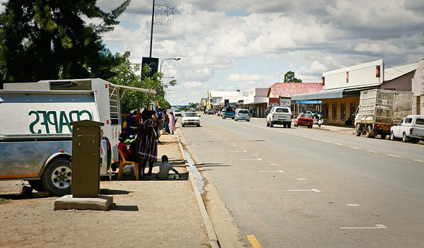
The city has six schools and two hospitals and all the conveniences for supplies or sleep.

The city's economy is mainly provided by Hardap Dam (the largest water reservoir of Namibia) , which allows it to thrive in the culture of corn, fruits and vegetables .
The city is also focused on the game farm, sheep, ostriches and cattle.


II.Information on other towns in Namibia

Arandis
Aranos
Aus
Bagani
Gobabis
Grootfontein
Henties Bay
Kamanjab
Karasburg
Karibib
Katima Mulilo
Keetmanshoop
Khorixas
Khowarib
Kongola
Luderitz
Maltahohe
Mariental
Okahandja
Omaruru
Ondangwa
Opuwo
Oshakati
Oshikango
Otavi
Otjiwarongo
Outapi
Outjo
Purros
Rehoboth
Ruacana
Rundu
Swakopmund
Tsumeb
Uis
Usakos
Walvis Bay
Windhoek


Source : 2011


Partners
Sitemap